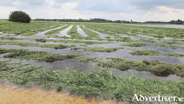
Athlone was one of four towns selected by CeADAR, Ireland’s centre for Applied AI, as a case study in the use of artificial intelligence and satellite technology to develop an early warning system for communities at risk of severe flooding.
Researchers used data collected by the European Space Agency’s Sentinel-1 satellite to map historical flooding events in flood-prone areas of Ireland.
The maps were then fed into an AI model designed to predict the extent of future flooding events in these areas. The model is accurate, researchers say, up to a distance of approximately 20 metres.
It is hoped the model will soon be used to forewarn threatened communities ahead of periods of heavy rain, providing local authorities with time to take emergency measures to limit damage to homes and businesses, evacuate residents, and protect livestock.
The flood prediction model forms part of CAMEO, the €9m project led by UCD to develop an Earth Observations (EO ) services sector in Ireland and explore the potential impact of EO data in the areas of climate, agriculture, and the marine.
The project is funded by the Department of Enterprise, Trade and Employment, and Enterprise Ireland under the Disruptive Technology Innovation Fund.
Athlone and its hinterland continues to experience flooding situations and with the prospect of weather conditions worsening in the coming years due to climate change, the Irish Fiscal Advisory Council has warned that extreme events as a result could cost the State around €500 million a year by the end of the decade.
“This project has major implications for communities in areas at high risk of flooding in Ireland. We’ve witnessed extensive flooding across the country in recent times and, with increasing greenhouse gas emissions certain to lead to more rapid climate change, we can expect even more intense precipitation events in the future.
“Predicting when and where a flood will strike allows time to organise mitigation measures, like preparing sandbags and evacuating people and livestock from certain areas. Traditionally flood prediction and mapping would have been based on weather models and low-resolution elevation maps, whereas this one is very much data driven, based on events over the past decade and the current situation in a given area. This creates an accuracy level that’s down to approximately 20 metres. The fine-grained and detailed picture would be an invaluable resource for many and we look forward to seeing it scaled up in the coming years,” Director of Applied Research at CeADAR, Dr Oisín Boydell, said.
