Search Results for 'Western River'
2 results found.
The canal
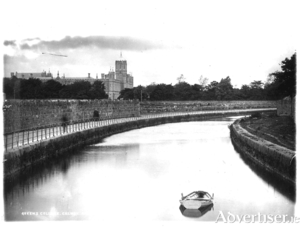
In 1872, SU Roberts, the Galway County Surveyor, wrote: “The lower lake empties its waters through a delta by three visible outlets: the natural and original shallow, tortuous and rocky Corrib River, navigable for only very small craft and row-boats on the west; the Mionloch Creek, a small stream, on the east and now nearly filled up; and through the boggy island covered with sedge between these two, by means of the “Friar’s Cut”, a canal of about three-quarters of a mile in length, fifty feet wide and twelve deep through the main stream passes. Besides these three streamways, there is a subterranean communication through the cavernous limestone, by means of ‘swallow holes’ near Tír Oileáin on the eastern shore which formerly carried off a large portion of the surplus waters of the lake, and discharged them into the sea near Oranmore”.
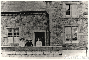
The lock keeper’s house
The Eglinton Canal was a work of great utility both in terms of draining and regulating the surplus waters of the lake and permitting ingress from the sea. The lower lake used to empty its waters through a delta by three visible outlets into the sea; The natural and original shallow tortuous and rocky Galway River, navigable only for very small craft and row-boats; The Mionlach creek, a small stream nearly filled up; “The Friar’s Cut”, about three quarters of a mile in length, fifty feet wide and twelve feet deep.

