Search Results for 'W'
2 results found.
Bohermore and some of its people
On the 1651 map of Galway, Bohermore is shown as running from The Green (Eyre Square) to the present Cemetery Cross where the ‘Old Gallows’ was located. There was also a gallows ‘where justice is executed’ near the Green. To the left and right of Bohermore, the land was known as St Bridget’s Hill and the region around Prospect Hill was known as Knocknaganach (Cnoc na Gaineamh), the Sandy Hill.
Mayo edge out Galway and the gales in Bekan
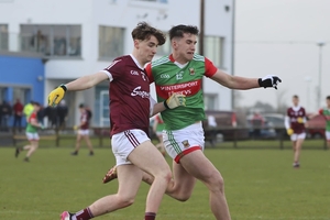
A cursory look at the scoreline - in years to come - will have people thinking that this was a game played out by two teams who weren't that good; but huge credit must go to both sides who put their best foot forward in terrible conditions in the Connacht GAA Centre of Excellence on Wednesday night.

