Search Results for 'Athy Castle'
2 results found.
From Crooked Lane to Church Lane
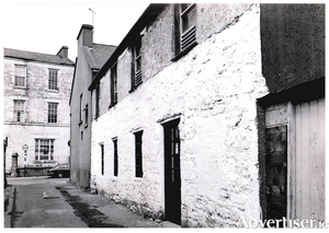
On a 1625 map of the city, this lane is referred to as ‘Crooked Lane’ and a little later in that century, it was commonly known as ‘Céim Cam’. In 1708 it was referred to as ‘Church Lane’ and on two documents dated 1824 it is down as ‘Bohercranmore’ (the Lane of the Big Tree) and also as Church Lane, sometimes called Lána an Teampaill. During the last century it was locally known as ‘O’Gorman’s Lane.
Market Street, 1880, a bird’s eye view
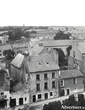
This photograph is part of the Clonbrock Collection in the National Library, and was taken from the tower of St Nicholas’ Church in 1880, looking over Market Street. This panoramic view extends as far as the river. The chimney you see on the horizon was that of Persse’s Distillery. In the distance (you probably will not be able to see it in this reproduction) is the Clifden railway embankment running along the river bank. The building that is now the County Club is near the top left of the picture, the tower of the Mercy Convent near the top right.

